

Automated Object Detection
Project Overview
WebCOOS Principal Investigator Dr. Dwayne Porter from University of South Carolina and his team are using artificial intelligence (AI) and machine learning (ML) software to perform feature extraction on camera feeds. Such feature extraction or object detection includes people and objects associated with beach utilization, i.e. beachgoers, swimmers, chairs, umbrellas. These automated processes can in near real-time provide timestamped counts and movement tracking within the processed camera feed images and derive trends from those collections. Similar to how businesses currently use webcam data to automatically monitor customer flows and habits to optimize their sales and transportation needs, webcams can be automatically processed to better understand crowd flow and safety for events related to beach access control and swimming advisories.
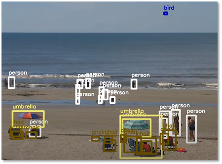
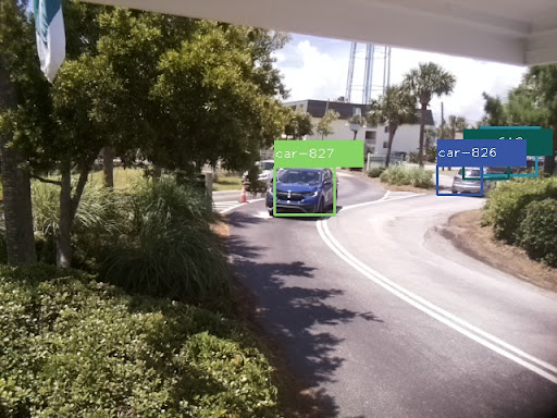
 Example images of object detection including people, birds, and vehicles
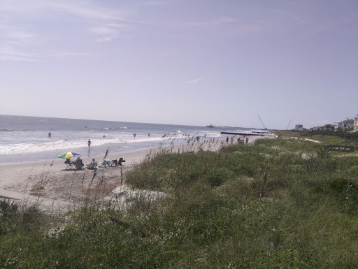 View from 6th Avenue beachfront, Folly Beach, SC Camera.
Why this Matters
This research provides information to coastal managers on how busy a location is during different times of the day, season, or year for planning purposes.
Products
Product Types
- Time series graphs with amount of objects detected
- Alerts based on object existence and/or counts
- Trends: number of people/cars/birds during a specific time period
How should I use these products?
- Cover monitoring gaps
- Document defined activities or events
- Alert and inform community members of defined activities or events
- Understand long-term and short-term trends of defined activities or events
- Utilize data to support decision making
What are the limitations?
Object detection is limited by distance, objects need to be large enough (more than 30 pixels) within the image to help define their shape for detection.
List of applicable cameras
Partners
- City of Folly Beach, SC
- South Carolina Maritime Museum Center of Excellence for Oceans and Human Health and Climate Change * Interactions
- Southeast Water Level Network
- North Inlet-Winyah Bay National Estuarine Research Reserve
- Charleston County Park & Recreation Commission
- Berkeley-Charleston-Dorchester Council of Governments

Rip Current Detection
Used to inform public of rip current dangers and issue alerts to lifeguards.
Read more
Shoreline change
Used to identify potential dune erosion or overwash events, infrastructure risk, and limitations to beach access.
Read moreAutomated Beach Usage Detection
Provides information to coastal managers on how busy a location is during different times of the day, season, or year for planning purposes.
Read more
Flood Monitoring
Helps to document flooding impacts and provide realtime alerts for local communities.
Read more